
Have you ever wondered what a modern American city looked liked 175 years ago?
An article in the Daily Mail that was shared with me today that featured the interesting work of David Rumsey who has spent 25 years collecting digitizing antique maps and making his work available for free via his website. Coupling the strength of his collection and the processing power of computers, he has been able to combine maps that allow viewers to see just how dramatically different cities looked nearly 2 centuries ago.
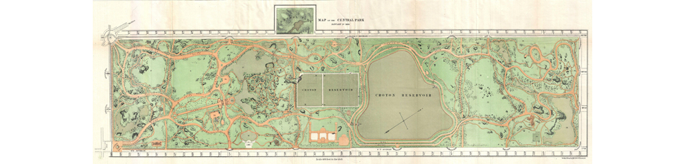
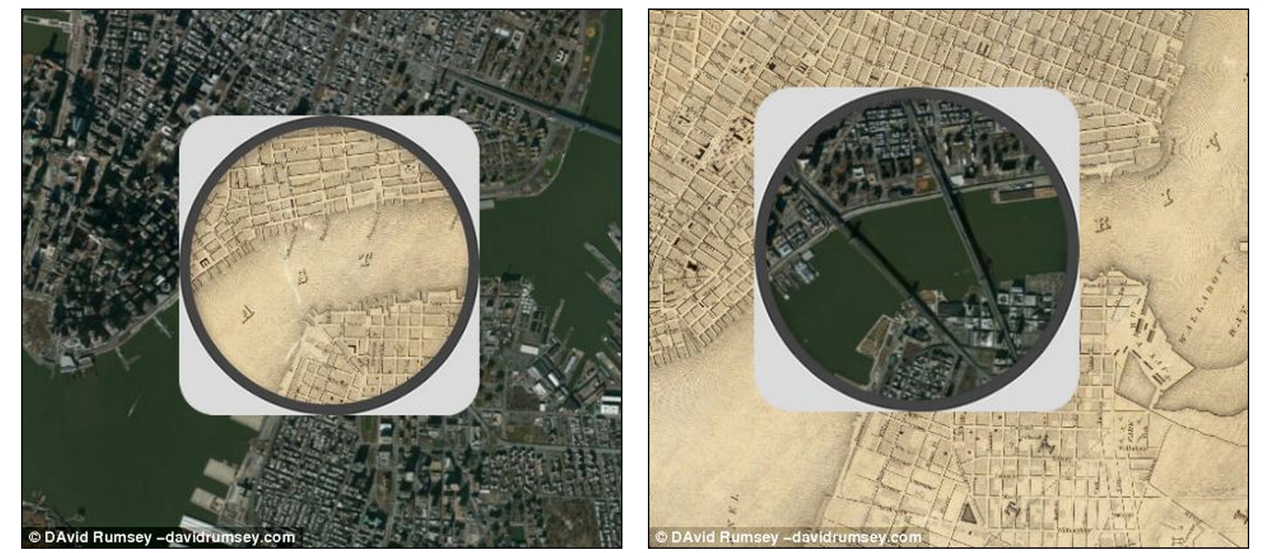
The example referenced in the article overlays a map of New York City made in 1836 onto a modern satellite map of the city and the differences are nothing short of amazing. We all know that the world we see today is considerably different than what was in place 200 years ago but the maps really drive the point home. In the New York City map, most of the main streets were already in place 200 years ago, but the impressive contrast happens when you reach midtown and uptown and realize that most of Manhattan was very much full of farms and green space.
Here is an example of the fascinating map — Notice that the Brooklyn Bridge and Manhattan Bridges are no where to be found in 1836!
In addition to the New York City map, The Smithsonian has used David Rumsey’s maps to compare 1858 Chicago, 1879 Denver, 1880 Los Angeles, 1851 Washington DC and 1859 San Francisco to their respective modern day versions. Some of these offer even more stark comparisons than the maps of New York.